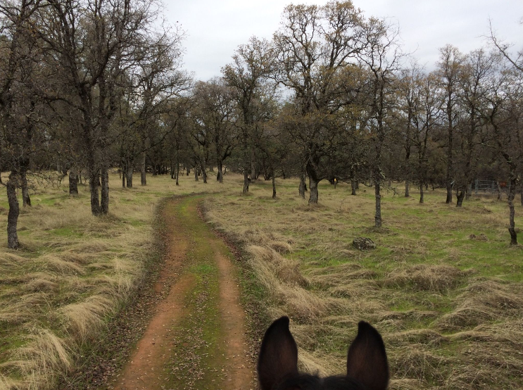
Trail Guide Part 3
| May 31, 2017 | Posted by Melinda under Training journal |
Trails featured in this post:
- Steven’s Trail, off I-80 near Colfax
- Sterling Pointe, Folsom Lake area
- Lake Oroville trailheads
A master list of all the trails featured in “Trail Guide” posts can be found here.
Stevens Trail
- Free parking (BLM land)
- Runners (horses aren’t prohibited…but good luck to you if you try it o_O)
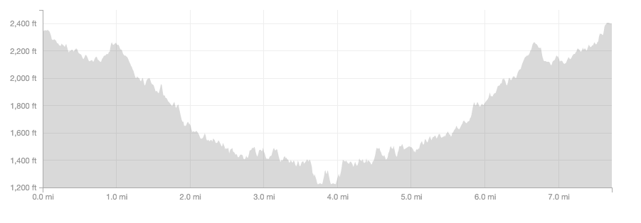
- Out and back 7.7 mile technical single track with a lot of elevation change
- Best for: you have a couple of hours and want to run in a pretty place with a bit of everything and get a solid training run in, without running double digits.
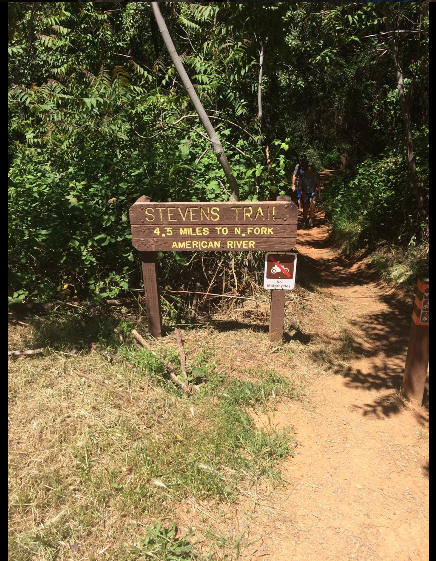
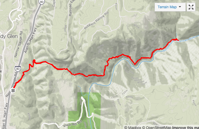
I GPS’ed it at 7.7 miles for the whole thing there and back so I’m not sure where the 4.5 mile end point is?
This is a recent discovery and I googled it’s location on a hiker friend’s recommendation. At the point of writing this post, this is hands down my new favorite running trail. It’s gorgeous technical single track that challenges and rewards, has great views of the river, stream crossings, and is very runnable.
The trailhead is right off of I-80 in Colfax so think of it as a rest stop? You need to stretch your legs before heading over Donnor into NV (or need to stretch them after doing Donnor into CA)? PERFECT. Head over to Steven’s trail, hit the toilet, and spend an hour or two playing on the trails without a lengthy driving detour. Clean up at the car and continue to destination!
Yes there’s freeway noise for the first stretch of the trail, but very soon it dives away and leaves it behind.
Park here
Here’s the trail from the parking area to the river and back.
I really doesn’t feel as bad as it looks!
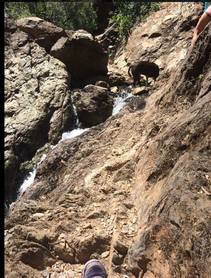
I didn’t get many pictures of the trail because I was too busy enjoying the sights and trying to stay upright. This is a section of the runners/hiking only trail (bikes and hikers split for a little bit) that crosses over the top of a small water fall with the trail cut into the rock of the cliff.
Sterling Point Equestrian Staging Area, Folsom area
- Free Parking
- Horses and Runners
- Access point to the Pioneer Express Trail
- Trail head maintained by volunteers and (I think) the county
- Best for: Access to Pioneer express trail for staging a point to point, or a no fuss spot to park for an out and back on single track of any distance.
Don’t want to pay to park at Granite Bay or Rattlesnake Bar? Still want to ride on the Pioneer Express Trail? Park here! Water troughs, bathrooms, and easy access to the single track Pioneer Express Trail along Folsom Lake. It’s much more rideable in this section than coming out of Granite Bay.
On the downside, if you don’t want to ride/run on the Pioneer Express Trail? Park somewhere else.
Park here
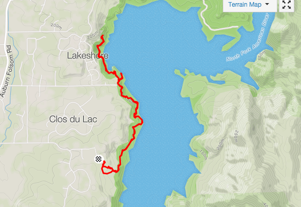
Sample trail going towards Rattlesnake Bar area
Oroville Lake/Dam Recreation
- 2 recommended trail heads – 1 paid (or poppy pass) and 1 free. Plus the visitors center (also free).
- Double digit runs and rides
- Moderate difficulty trails
- Just because my horse is sick of these trails doesn’t mean yours is!
- Best for: general training
Oroville is THE place I’ve done the majority of my training for endurance rides the last couple of years, and I logged a lot of runs out there too prepping for my 100 miler last year. There isn’t an infinite variety of trails but there’s enough to keep you occupied for a while.
Trailhead security can be a risk, especially in the free parking areas. My advice to is to keep all valuables completely out of sight in your vehicle, and put any tack in your horse trailer tack room on the horse. It’s inconvenient, but I empty out the trailer of most of my extra tack when riding here if using the free trail heads. There hasn’t been any problems I’m aware of at the paid area (Potter’s). One of the free trail heads that I used to ride out of 10 years ago I no longer recommend at all because of security problems/gang activity. It’s tucked away into the back of a neighborhood which contributes to the problem. The other free area is off of a major road and I still feel comfortable using it – especially if I’m not pulling a trailer and just have my car for a run. I don’t want to scare you off – these are some great trails to put some miles on. Just be smart. FWIW I’ve been riding there for over a decade and haven’t gotten broken into.
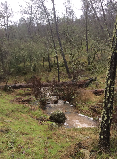
Here’s a map to orient you:
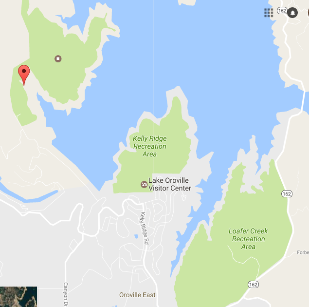
Upper left red dot is Potter’s trail head. The Saddle dam day use area trail head is further down in the Loafer Creek Recreation area. The Visitor center is marked and located in the Kelly Ridge Recreation area. There is a trail that connects Kelly Ridge to Loafter Creek areas, so and is used to access both areas from either trail head.
At the Loafer area (access via the Visitor’s center or Saddle Dam off of Kelly Ridge road) there are some bike and horse specific trails, runners can use either one. In general they are well marked but everything loops around and it can be confusing. Bring lots of water, and usually by the time you don’t know where you are, you stumble into a campground or a boat ramp with a posted map.
Potter’s area is more straight forward, trails are open to both horses and bikes.
On a horse you can’t access the Potter’s side trails from Loafer side (and vice versa). As a runner, you can run across the dam, although the road on the the other side going up to Potters is narrow and windy (and short) and is a major road for traffic pulling boat (and horse) trailers. Doesn’t sound like fun to me.
Park here – (Potter’s)
- 2017 season IMPORTANT: The access road to this trail head was washed out by the emergency spillway so currently this trail head is inaccessible. Sucks. Earliest it will re-open is 2018
- Paid or Poppy’s pass
- More rocky than Loafer Creek area
- Less Elevation gain
- If not pulling a trailer can park for free just outside the entrance on a cul-de-sac.
See where it says Boat Launch? That’s where the actual parking is. just after going through the entrance gate, go right into the gravel equestrian parking.
Here’s some trails for this area:
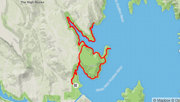
On this ride I turned around early. The trail continues out another mile (2? 3? can’t remember) until you get to a boat in campground.
Park here – (Saddle Dam Day use area – access both Kelly Ridge and Loafer Creek)
- Free
- Loop options
See the gravel parking lot right behind the pin on the map? That’s the parking area.
Here’s an example of trails in the area.
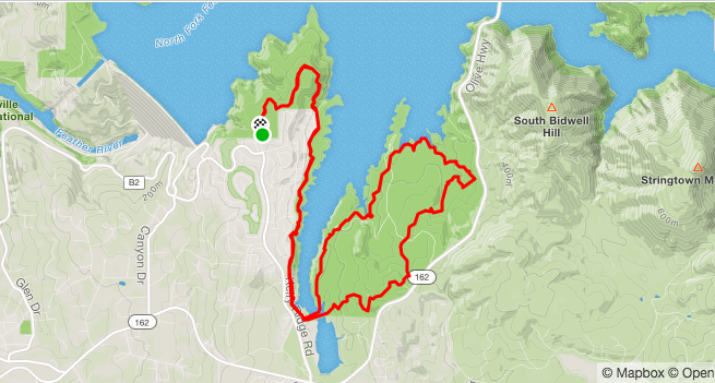
Note that this ride started at the visitors center, NOT the saddle dam trail head. . Trailhead is at the bottom where the trail goes from a loop to an out and back
Park here – (visitors center)
- Free
- No horse trailer parking, although there is a small unofficial lot that can hold a couple of trailers…but I wouldn’t count on it, and it might be hard to turn around with a big trailer. Especially if you aren’t familiar with the trails, I recommend parking at the main trailer parking area at Saddle Dam.
- Same trails as above for Kelly Ridge/Saddle Dam. There is a short section of trail that continues past where the above map ends, that goes to the Dam.


