Trail Guide part 2
| May 15, 2017 | Posted by Melinda under Training journal |
Trails featured in this post:
- Magnolia/Cronan on HWY 49 near Cool
- Driver’s Flat near Foresthill
- Sutter Bike Trail, Yuba City
- Cache creek trail heads – Judge Davis, Cowboy Camp, High Bridge
- Cascade Canal Trail, Grass Valley/Nevada City
- Empire Mine, Grass Valley
In case you missed it, here’s part 1 with all the “use at your own risk blah blah blah stuff”.
Magnolia/Cronin(Cronan)
- Free parking
- Horses and runners
- Easily get 14-15 miles without repeating trail
This is a trail that I discovered this year thanks to my friend Lucy. She put me together a run that showed off it’s best attributes and I’ve been obsessed ever since. It’s mostly wider road type trails with some double and single track thrown in. Excellent views of the river and there’s a part of the trail that parellels the beach with bathrooms. It’s a mix of up, down and some flats, incredible views on the ridges and river access. There’s also an old movie set!
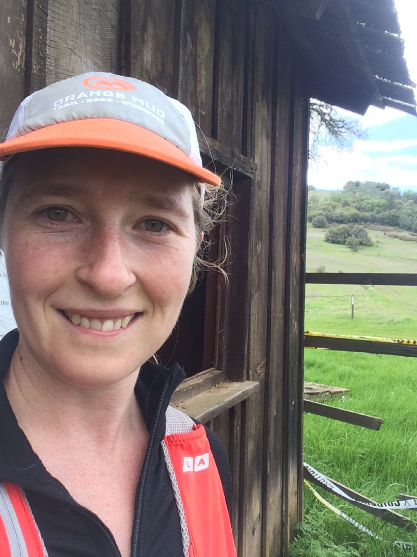
Movie set
It’s fairly easy to find your way around without a map but the trails are not marked especially well so sometimes you don’t know which trail you are on (but the trails are wide and well established so no danger of wandering off into the wilderness), and some are marked wrong. However, it’s hard to get lost since it’s wide open and you generally know the direction you need to head.
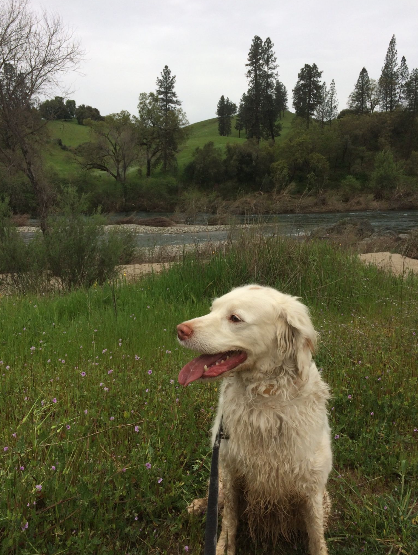
Down by the river
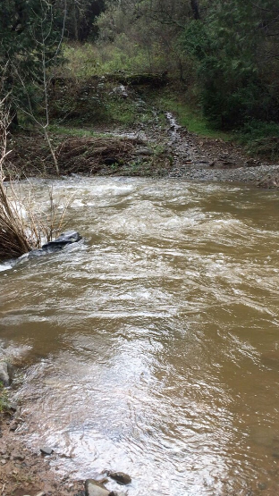
One other caveat. If planning a route that requires you to cross a normally placid ankle deep stream that separates Magnolia from Cronan trail heads on the connector trail….there are times during the winter that it apparently turns into a waist high or deeper angry rushing torrent of water, as I found out on a run. Not for long, but if you have poor timing, you might find yourself doing your ride or run in 2 stages – completing a loop and then moving your vehicle to the other trail head to finish your outing.
Park here (Magnolia)
Or here (Cronan)
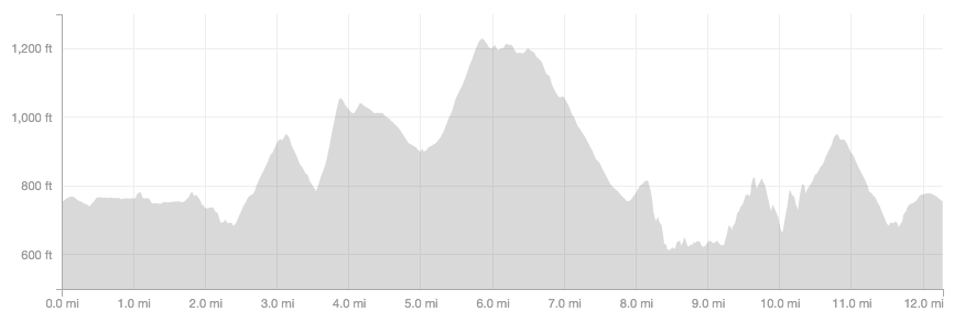
Example trail map
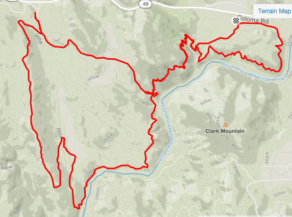
Start and finish (black and white marker) is at Magnolia. The small out and back section at the top of the left hand loop is to the bathrooms at the Cronan parking area. The stream crossing is on the trail section between the two loops.
Driver’s Flat
- Runners and horses
- Parking Fee or Poppy Pass
- Mostly flat with some a few significant climbs (including to and from the trail head).
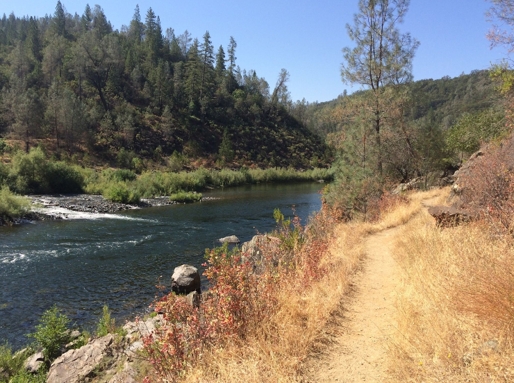
On the CA Loop summer time
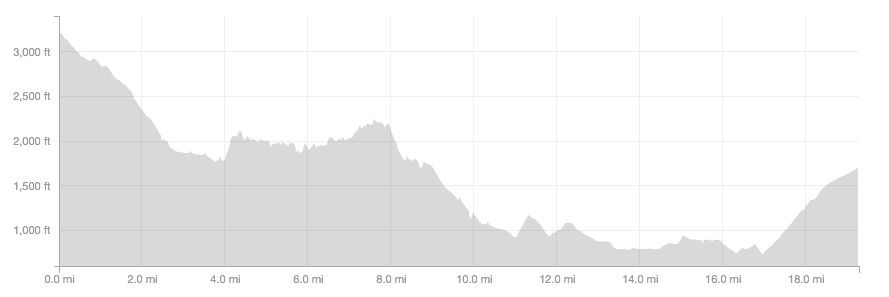
Drivers Flat is the main parking area to access the section of the Western States Trail that runs between Foresthill and the American River. This is referred as the “California Loop”.
There are some other trail options from this parking area – white oak flat to fransico’s and back, and if you want to cross the highway toward Lake Clementine – but since I’ve never been on those trails, I won’t comment on them at this time. I will update this section when I do!
The CA Loop is an almost-20 mile section of trail that is not especially technical, but is narrow at times with steep drop offs to the river below. Green horses not recommended. It can also be difficult to pass on sections if two horses are traveling opposite directions. The most common direction of horse traffic on the trail is from Foresthill to the river. Also note that during the winter parts of the trail can be blocked by fallen trees etc that will probably be passable for a runner, that won’t be for a horse. I don’t recommend riding this trail early in the season (or at least check with other riders or runners before heading out).
For a point to point park at Foresthill on the main street. Please be courteous to businesses and property owners when parking. Once parked, head down CA street (paved), get on the trail that is at the end of the road. Shortly cross a paved road to continue on Trail. Trail is sporadically marked with brown “WS trail” markers. There are 2 right turns that can be a little tricky and easy to blow past if you aren’t paying attention. They come in the first 3 miles of the run, after you cross the paved road. When you get to the wide dirt jeep road, follow it o the left, while paying attention for the WS trail markers marking your turns to the right. Once on the single track after this point, it’s almost impossible to make a wrong turn and the trail is well marked with signage and even big “miles to next trail point” sort of signs.
Note that there is no potable water on the trail and the river can be difficult to access. In the summer time if you are a slower runner like me, make sure you carry plenty of water, and I recommend carrying a water treatment method.
Past Rucky Chucky you can choose to continue up the big jeep road to the Driver’s Flat staging area, or head left on another single track that will take you to the river (Poverty Bar). You will likely not be able to cross the river, so once at the river back to Drivers Flat.
Parking for Driver’s Flat
Sutter Bike Trail
- Paved out and back trail that runs between Yuba City and Sutter
- No car traffic or horses allowed
- Several areas to park along the trail
This is a flat, paved section of trail that is great for sprints, head training in the summer, or when you want to get a run in uninterrupted by signal lights, but don’t have time to get out of town.
The official start of the bike trail
I usually park here
Example trail map
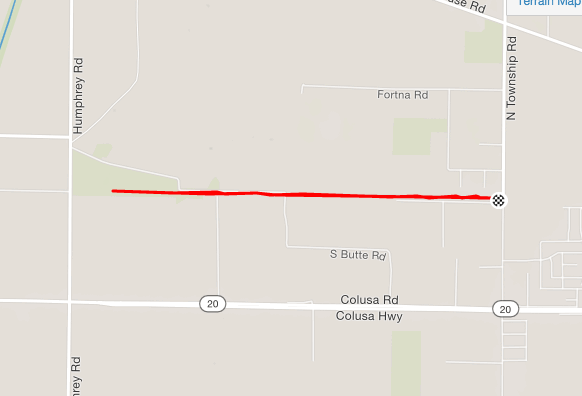
Just a short portion of the “trail”. From this parking lot it’s 6 ish miles to go all the way to Sutter and back.
Cache Creek trails – Judge Davis, Cowboy Camp, High Bridge
- BLM land, free parking
- Runners and Horses
- Hills, sun
- Wide easy to follow trails
- No cell service
This public use space is a gem. It’s free, there’s a horse camp (Cowboy camp – no potable water, but access to the creek, bathroom), multiple trailheads with toilets, and if you plan your route right – 50 miles of trails without coming back to your trailer.
I haven’t seen a well marked map, but like Magnolia the trails are wide and easy to follow – you just might not know which one you are on for sure without a little exploring.
I find that these trails are best for hill work and long runs/rides. In the summer the trail can be very exposed and hot with minimal water on the trail.
Parking – cowboy camp
Parking – Judge Davis
Parking – High Bridge
– can’t find on google maps right now – it’s on HWY 16 on the right hand side, as you continue past Cowboy camp away from HWY 20. Will update soon!
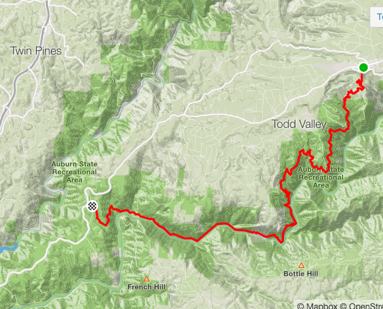
I don’t have any recent good rides/runs out there so I’m limited on what I can share with you. My most recent ride out of Judge Davis is pitiful in terms of what it shows you on the map, but it’s better than nothing right?
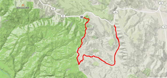
The point that I turned back is actually another small parking area. Too small for trailers and when getting back on the highway, REALLY difficult to see traffic because of how the road curves. Hence the name “dead man’s curve”. I recommend either going up to Judge Davis (where this ride started, at the black and white circle) or parking at one of the other trail heads.
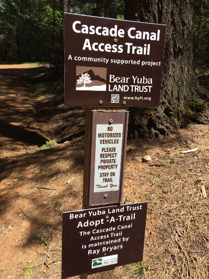
Cascade Canal trail
- Free parking
- Flat
- Shaded
- 9 miles (there and back)
- Runners, but not good for ponies. The parking won’t accomodate a trailer, and there are a couple of gates with walk throughs on the trail that won’t accomodate horses.
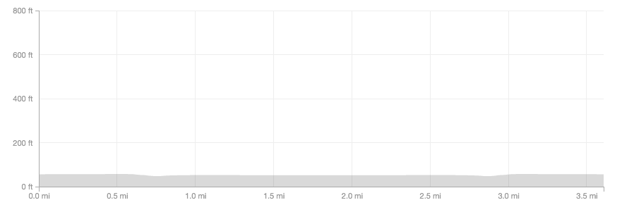
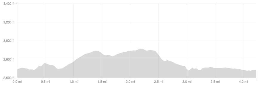
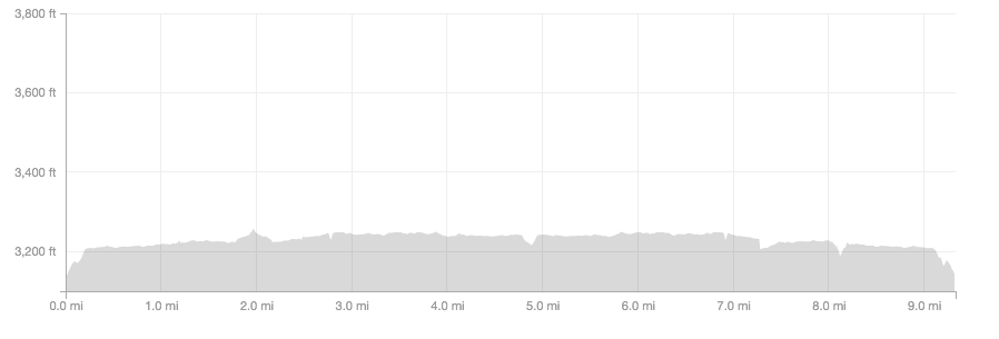
Flat isn’t that special down in the valley where I live, but flat up in Grass Valley is a rarity. This is a 4.5 mile mostly flat, non technical, well marked, partially shaded trail that parallels a canal. Through some trick of angles and horizons it appears as if you are going up hill BOTH directions – at least to my brain, making it an excellent mental training. I kept turning around on the way home to check whether it was really uphill on the way out because it looked and felt the same going back to the car….and then when I looked at the elevation map it was flat. So weird.
A great trail for long sustained running paces (like the Sutter Bike trail) but without the pavement!
Mile markers every 1/2 mile and 1-2 opportunities for a side trip. I haven’t explored those yet, but will update when I do.
After the trail “ends” at Red Dog road the canal continues on with a single track next to it. I’m not sure whether it’s public access or private land, so did not continue – I had come to the end of “Cascade Canal Trail”.
One of the fun things about this trail is going over the catwalks next to the big culverts suspended above the creek. It looks like exactly the sort of thing you would be told to stay off, but YES, that’s the trail. The first one will appear on your left. If you continue to follow the trail and NOT cross it, there is a creek crossing further down to bypass it (for bikes etc.).
Note that you will not have to cross into any areas that are marked as private or no trespassing. As you cross the first cat walk (or go further down to cross the stream on foot) if you turn to the right, you will end up going out an access road that dead ends into private drive ways. They are marked with no access, and then you know you went the wrong way! Turn around and continue to follow the marked “Cascade Trail”.
Where to Park
Trail Map
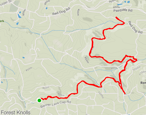
Parking for the outback and the green circle on the lower end of the map.
Empire Mine
- Horses and runners
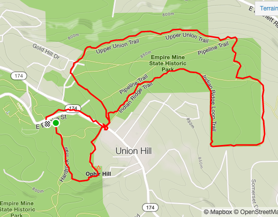
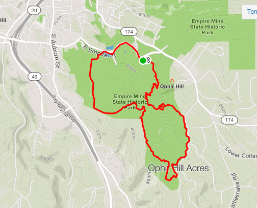
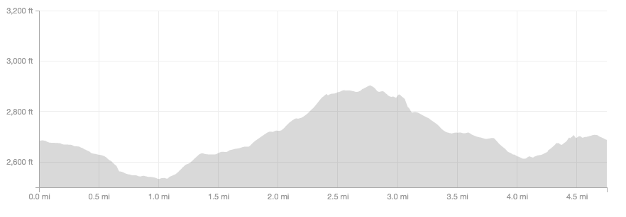
- Two loops of ~4.5 miles without repeating trail. Longer options if you repeat some trail and use the “inner” trails.
- Parking is free!
- Lots of shade
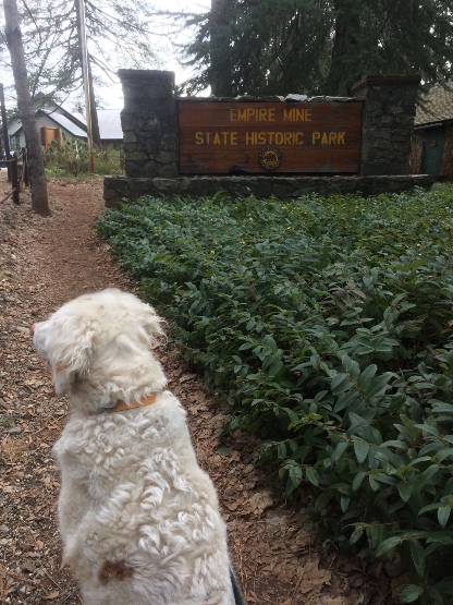
Horse trailers should park Penn Gate. If you are running, park either at Penn Gate or drive a mile up the road and park at the visitors center.
Trails are wide and generally easy to follow. However, I’ve unintentionally gotten off trail following a route that clearly used to be a trail, but now isn’t because when I got to the end when it connected to a “real” trail there’s barricades that say “stay on the trail”. I do my best…..
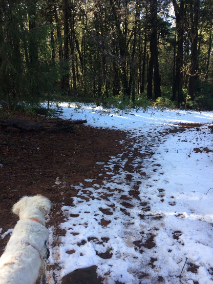
Runnable year round, even with snow.
Penn Gate Parking
Visitor’s center parking
Union Hill Loop
Osbourne Hill/Hardrock Loop
More coming!


